


Spring Creek Precinct, Custer County, Nebraska
About
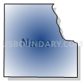
Outline

Summary
| Unique Area Identifier | 612645 |
| Name | Spring Creek Precinct |
| County | Custer County |
| State | Nebraska |
| Area (square miles) | 30.96 |
| Land Area (square miles) | 30.96 |
| Water Area (square miles) | 0.00 |
| % of Land Area | 100.00 |
| % of Water Area | 0.00 |
| Latitude of the Internal Point | 41.47733870 |
| Longtitude of the Internal Point | -99.27675000 |
Maps


Graphs
Select a template below for downloading or customizing gragh for Spring Creek Precinct, Custer County, Nebraska


Neighbors
Neighoring Voting District (by Name) Neighboring Voting District on the Map
- Comstock Precinct, Custer County, NE
- Douglas Grove Precinct, Custer County, NE
- Myrtle Precinct, Custer County, NE
- Precinct 7, Valley County, NE
- Westerville Precinct, Custer County, NE
Top 10 Neighboring County Subdivision (by Population) Neighboring County Subdivision on the Map
- Arcadia township, Valley County, NE (397)
- Comstock township, Custer County, NE (155)
- Westerville township, Custer County, NE (152)
- Myrtle township, Custer County, NE (102)
- Douglas Grove township, Custer County, NE (97)
- Spring Creek township, Custer County, NE (15)
Top 10 Neighboring Unified School District (by Population) Neighboring Unified School District on the Map
- Broken Bow Public Schools, NE (4,934)
- Ord Public Schools, NE (3,531)
- Ansley Public Schools, NE (1,048)
- Sargent Public Schools, NE (998)
- Arcadia Public Schools, NE (530)